 TBSD60
 BSD120
 BSD98
BSD98 BSD70
BSD70 BSD60
BSD60 BSD50
BSD50 BSD217
 INS1700
 INS970
 INS570
 INS170
 SLA-4B1L1-65
 SLA-4B1L1-130
 SLA-8B1L1-165
 DIVER 101
 DIVER 102
 DIVER 103
 DIVER 104
 DIVER 105
 DIVER 106
 SLLR3000
 SLLR905
 SLLD25
 160M
160M 170M
170M SLFC-70
 SLAF280
 MR360
MR360
Leave Your Message
Engineered for extreme environments, our top-tier inertial sensor systems deliver pinpoint accuracy where GPS cannot reach. Explore our flagship models designed specifically for Measurement While Drilling (MWD) and automated mining operations.
In the highly demanding sectors of directional drilling and underground mining, knowing the exact position, heading, and attitude of equipment is not just a matter of efficiency—it is a critical safety and operational requirement. Unlike surface operations that rely heavily on Global Navigation Satellite Systems (GNSS) like GPS, subterranean environments are entirely devoid of RF signals. This is where the Inertial Sensor System for Directional Drilling and Mining becomes the undisputed technological cornerstone.
Deep beneath the earth's surface, rock formations and dense soils block all satellite communication. To navigate these "GPS-prohibited zones," drilling rigs and mining vehicles must rely on self-contained navigation technology. Our integrated navigation systems utilize high-precision Fiber Optic Gyroscopes (FOG) and advanced Micro-Electro-Mechanical Systems (MEMS) accelerometers. By continuously measuring the specific force and angular rate of the equipment, our systems calculate position via sophisticated dead-reckoning algorithms, completely independent of external signals.
These systems are engineered with robust anti-interference capabilities, ensuring that immense vibrations from drill bits and magnetic interference from surrounding iron ores do not compromise navigational integrity.
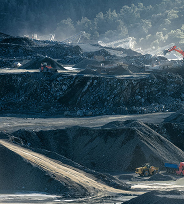
The global market for directional drilling and automated mining is experiencing exponential growth. As easily accessible surface resources deplete, the energy and mining sectors are forced to dig deeper and drill longer horizontal wells. In unconventional oil and gas extraction (such as shale gas), multi-pad drilling requires wellbores to be spaced tightly together. A slight deviation in the drilling path can result in catastrophic well collisions, leading to millions of dollars in Non-Productive Time (NPT) and environmental hazards.
Industrially, operators are shifting away from traditional mechanical gyros toward solid-state Inertial Measurement Units (IMUs). The demand for high-temperature, high-pressure (HTHP) tolerant inertial sensors is at an all-time high, driven by the need for real-time, accurate data to optimize well trajectories and maximize resource recovery.
The versatility of our Inertial Sensor Systems allows them to be seamlessly integrated into various critical phases of drilling and mining operations. Below is a deep dive into how our technology is revolutionizing these fields.
In MWD and LWD applications, our inertial sensors are housed within the Bottom Hole Assembly (BHA) directly behind the drill bit. They provide real-time continuous surveying data, including inclination, azimuth, and tool face angle. This data is transmitted to the surface via mud-pulse telemetry or electromagnetic telemetry. With our high-accuracy sensors, drillers can steer the bit precisely into the target pay zone, minimizing wellbore tortuosity. Less tortuosity means less friction on the drill string, faster drilling rates, and easier casing installation.
The future of mining is autonomous. Load, Haul, Dump (LHD) vehicles operate in dark, dusty, and narrow underground tunnels where human operation is dangerous and inefficient. Our lightweight inertial navigation sensors act as the "inner ear" of these autonomous vehicles. By fusing INS data with LiDAR and odometry, the vehicles maintain spatial awareness, avoiding collisions with tunnel walls and optimizing haulage routes. Our sensors feature a start time of less than 1 second, ensuring rapid deployment and minimal downtime.

Accurate mapping of existing wellbores is crucial for secondary recovery operations and structural integrity assessments. Drop-gyro surveys utilizing our micro-nano Angular Rate Sensor Fiber Optic Gyros provide zero-drift operation. They can map the precise 3D trajectory of a borehole without being affected by the magnetic anomalies present in steel casings or iron-rich rock formations, filling key technological gaps in the global market.

The evolution of the Inertial Sensor System for Directional Drilling and Mining is moving rapidly toward miniaturization, extreme environment tolerance, and Artificial Intelligence (AI) integration. As drilling tools become more compact, the demand for tactical-grade MEMS that offer the performance of FOGs but at a fraction of the size is surging. Furthermore, AI and machine learning algorithms are now being embedded directly into the sensor's processing unit. These proprietary algorithms actively model and predict sensor drift based on dynamic temperature and vibration profiles, effectively extending the duration of accurate navigation before a Zero Velocity Update (ZUPT) is required. This reduces costs by 25% and improves overall system performance by 20%.
By integrating industry-specific requirements, we have made significant technological advancements in digitalization, automation, and intelligence.

Independent self-development reduces costs by 25% while maintaining strict quality control.
Advanced error compensation algorithms improve navigational performance by 20%.
Ensuring stable quality and efficiency for large-scale mining and drilling deployments.
Delivering cross-industry solutions from raw components to full autonomous systems.
Connecting the World Through High Accuracy Navigation Technology
Based in Hong Kong, Poseidon International Group is a global enterprise dedicated to delivering high-quality products and professional services. We have established long-term, stable, and efficient partnerships worldwide. Our core team comprises seasoned experts with extensive backgrounds in aerospace and inertial navigation. We have successfully tackled critical technological challenges in high-precision GNSS-free navigation, laser measurement, multi-source data fusion, and precise positioning—areas that were once bottlenecks in the industry.
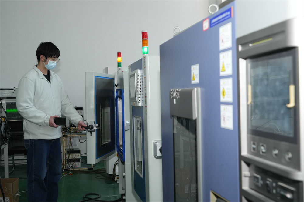
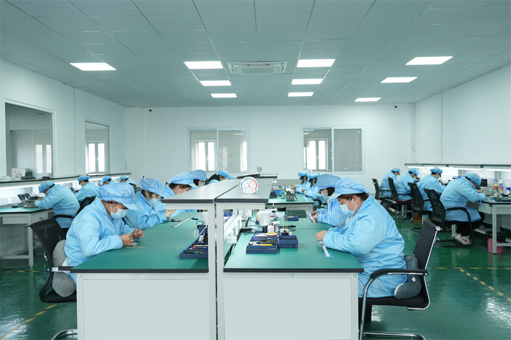
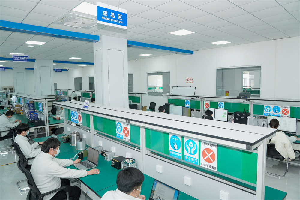
We operate an over 6,000-square-meter manufacturing facility equipped with advanced R&D, production, and testing infrastructure. Our products are smaller in size, higher in accuracy, and more stable in performance, featuring long-term dynamic auto-calibration with zero-drift operation. They have passed rigorous validation in aviation, marine, mining, and drilling applications.


We provide comprehensive, all-in-one solutions, whether for components, products, systems, or complete project solutions, ensuring the best value.

Our experienced team, with deep expertise in international trade, is dedicated to crafting cost-effective solutions tailored to customer needs.

Through close partnerships with leading logistics providers, we guarantee timely and secure deliveries for your critical mining operations.
Compared to similar companies, we offer unique advantages that ensure our clients in the drilling and mining sectors receive unparalleled support and technology.

Creating mutually beneficial relationships with clients and partners in the resource extraction industry.

A strict commitment to ethical business practices and reliable engineering data.

Providing clear, one-time offers with no hidden costs for our high-end sensor systems.

24/7 service guarantee in all time zones with minimal response time for field operations.
Browse our full range of advanced inertial sensors, flight controllers adapted for automated rigs, and subterranean positioning systems designed to meet the rigorous demands of modern directional drilling and mining.


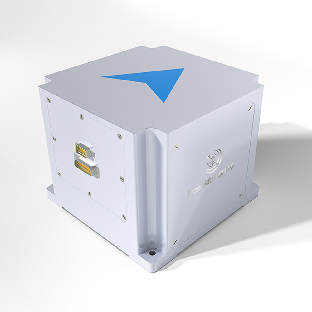
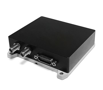
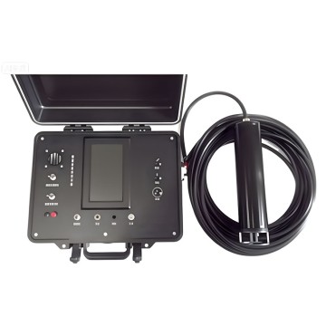
 DIVER 104 Underground Directional Drilling Navigation System
 MEMS 170M - High-Shock Mining Sensor
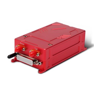
 TBSD60 Digital INS for Autonomous Mining Vehicles
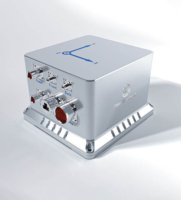
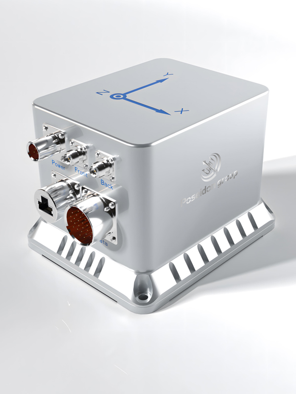
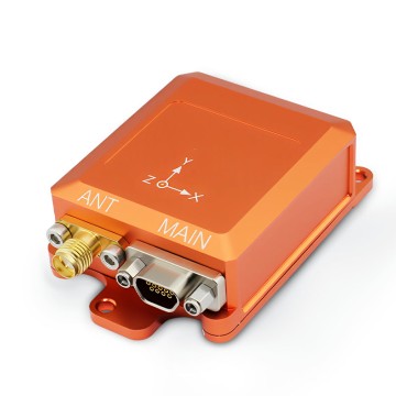
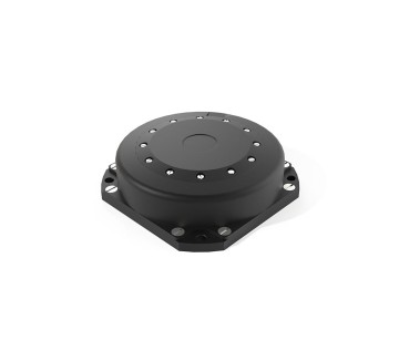 BSD120 Precision Borehole Surveying Sensor
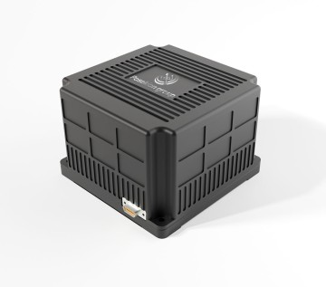
 SLFC70 Intelligent Brain for Automated Drilling Rigs
 DIVER 101 Subterranean Positioning System
 MEMS 160M - Ruggedized MWD Sensor
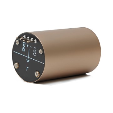 Micro-nano FOG for Rapid Mining Deployment